
Storm Floris, the sixth named storm of the 2024 to 2025 season, is due to hit on Monday 4 August, with the Met Office issuing a yellow weather warning for certain parts of the country.
Those in the worst-affected areas can expect to see wind gusts of up to 85mph and there is a risk of life warning out due to flying debris. While storms are usually more common over the winter and the autumn months, the Met Office has said that storms like Floris can occur during the warmer summer months.
But what do you need to know about Storm Floris as it hits? Read on to find out…
Worst-affected areas
The Met Office has issued a yellow weather warning for northern England, northern Wales, and the entirety of Northern Ireland and Scotland. The warning will be in effect from 6am on Monday until 6am the following day; the yellow warning will remain in place for more eastern regions.
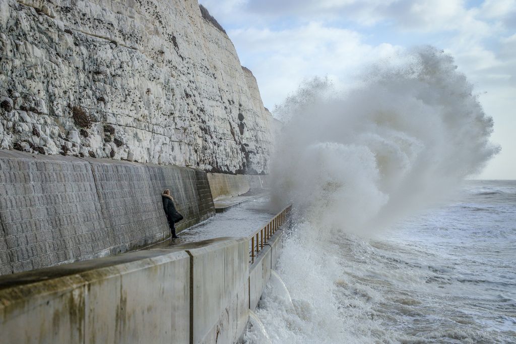
Gusts, which could reach up to 85mph, are expected to begin easing off in more western regions late on Monday. These winds are expected closer to coastal areas, but inland areas can still expect to see gusts of between 40 and 50mph.
During this time, there is a risk of life due to flying debris, including roof tiles. Other dangers include “large waves and beach material being thrown on to sea fronts, coastal roads and properties”.
There will also be the possibility of power cuts as well as disruption to travel services, including roads, trains, ferries and planes. In some instances, bridges may also close in the windy weather.
 © Getty Images
On its website, National Rail says: “It is likely that speed restrictions will be in place and your journey may take longer. There are currently no service alterations in place, but as soon as we have any further details, we’ll publish the information here.”
Matthew Lehnert, a chief meteorologist at the Met Office explained: “Across the warning area, many inland areas are likely to see gusts of 40-50mph, with 60-70mph more likely at higher elevations and around exposed coasts in Scotland. There is a small chance that some locations here could even record gusts of 85mph.”
Staying safe
The Met Office has plenty of tips on how to stay safe during a storm, with one of its most pertinent pieces of advice being to remain indoors while the storm rages on outside. However, if you do need to go outside, make sure to avoid walking close to buildings and trees.
The sheltered side of fences and walls are particularly dangerous, as if they collapse, it is the sheltered side in which they’ll collapse onto.
 © Getty Images
When it comes to driving, while it’s advised to delay the journey, the Met Office recommends considering slowing down. It also advises you to keep a check on sidewinds if you’re towing another vehicle or if you’re driving one with high sides, such as a lorry.
Even once the storm has blown through, you should avoid walking near trees, buildings and walls as they may have been weakened by the winds and are still vulnerable to collapsing.
Previous storm
Before Floris, the last named storm to hit the United Kingdom was Storm Éowyn, which happened in late January. The storm was formed from the remnants of the Gulf Coast Blizzard and caused both red and yellow weather warnings to be issued.
 © Getty Images
Some winds were recorded as high as 100mph, while 106,000 properties in Scotland faced power cuts.
Read the full article here